
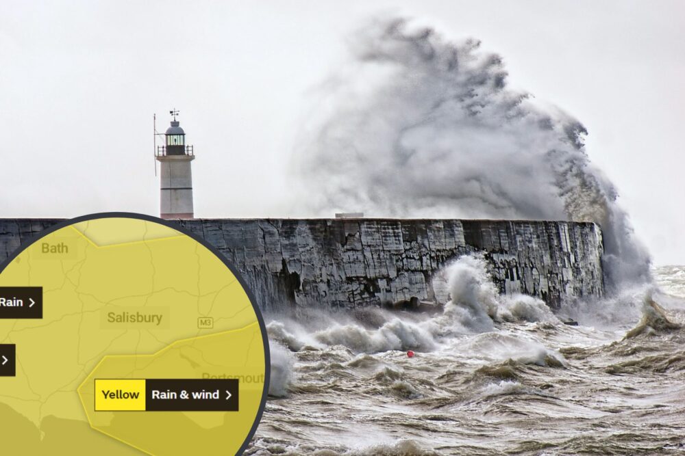
FLOOD warnings are in place for much of the Dorset coast – as well as much of Somerset, Wiltshire and Hampshire – as Storm Ciarán approaches.
The warnings advise people in the areas to “take action” as flooding is “expected”.
“Flooding is expected in this area,” an Environment Agency spokesperson said. “This means properties are at risk of flooding.
“Please take action to protect yourself and your property and monitor local weather and river conditions.
“Avoid contact with, walking or driving through flood water. Consider activating any property flood protection products you may have.”
The warnings cover the following areas:
- Christchurch Harbour Side: Areas in close proximity to Christchurch Harbour including Mudeford, Stanpit, the Quomps and Wick.
- Swanage Bay: The High Street, The Square, The Parade and The Mowlem.
- Wareham: Wareham Quay, Ridge, Redcliffe and Swineham areas.
- West Quay and Lower Hamworthy Quay: Lower Hamworthy and areas of Poole from Old Town, The Quay to Hunger Hill.
- West Bay Harbour and Esplanade: Properties along and behind the Esplanade, Quayside, Heron Court, Forty Foot Way, Driftwood, Fourviews, Britbank, Barwick, Sunset, Riverside, George Hotel, Colmer Lodge and the Parkdean Holiday Park.
Heavy rain and strong winds are forecast for the coming days, with people urged to expect delays to train and bus services, flooding and damage to some buildings, as well as fast-flowing or deep floodwater “causing a danger to life”.
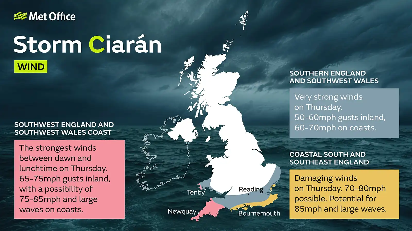
A weather warning for Wednesday morning covers much of the Purbeck area, including Wareham, with others in place across the whole of Dorset, Somerset, Wiltshire and Hampshire for Thursday.
READ MORE: Wet weather driving: Advice issued ahead of Storm Ciarán hitting the UK
“Travel disruption is possible from a combination of heavy rain and strong winds on Wednesday morning,” a Met Office forecaster said.
They warned of:
- Some interruption to power supplies and other services likely and damage to trees is also possible
- Spray and flooding on roads probably making journey times longer
- Delays for high-sided vehicles on exposed routes and bridges likely
- Some short term loss of power and other services is possible
- It’s likely that some coastal routes, sea fronts and coastal communities will be affected by spray and/or large waves
- Some delays to road, rail, air and ferry transport are likely


Leave a Reply