
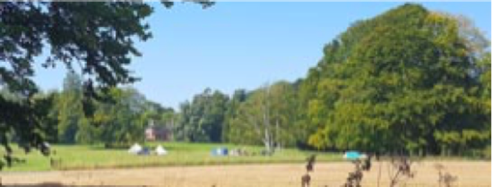
This is an undulating walk of about seven miles, giving wide views over the Vale and visiting interesting features.
Start at the church, taking time to look at the massive box tombs and the stocks, then cross the main road and head south west along Church Lane, which branches left and continues gently uphill, passing under a railway bridge. Until the railway is reinstated the line is used as a trailway by walkers, riders and cyclists.
Church Lane passes the cemetery, which you might like to visit. It’s uncanny how often I see names I recognise on gravestones. The Tarmac now runs out and the lane becomes a bridleway between trees and hedges and a monument to Fred Flintstone. Continue for another couple of miles, passing Gorcombe Farm, which has an adventure activities centre, which looks fun.
When you get to Charisworth at the brow of the hill, pause to look at the view over the Vale, then turn left and head eastwards alongside the parish boundary, which follows Combs Ditch, an Iron Age earthwork that was revived after the Romans left to help keep the Saxons out. Much of it is a bank and ditch alongside a bridleway. Many of our boundaries follow ancient lines. The Dorset County Boundary Group is currently researching the Shire Rack, our boundary with Wiltshire through Cranborne Chase.
Our route soon branches left, NE, then veers East across Charlton Down then heads NE along a track downhill for about three miles. You’ll see a solar farm to your left which, I learn from the BVM, is the subject of a planning application to enlarge it.
Continue past North Farm and eventually you’ll reach the main road, where you turn left and walk a mile back to where you started.
Support Us
Thank you all so, so much for the love and appreciation you’ve shown us since we launched the New Blackmore Vale.
Please show your support and add a review on our Facebook page or on Google.


Leave a Reply