
With retired Dorset rights of way officer Chris Slade
Distance: Approx 4 miles
This walk weaves you for five miles about the parish of Beer Hackett. The village is about five miles south west of Sherborne and a mile north of Yetminster. Park by the church, which is worth a visit. It’s rather large when you consider that the population of the parish is only about 100. Take the footpath heading north from the nearby Church Farm, crossing several low lying fields with clay soil. After half a mile you’ll reach the parish boundary, which follows a stream.
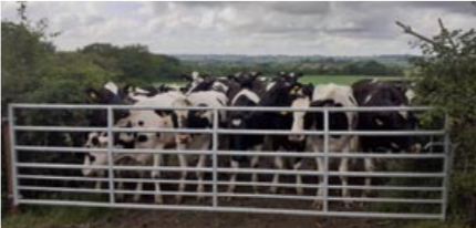
Double back and head south east along a footpath, crossing more fields, possibly with lots of cows. Don’t worry if you meet cows when out walking. They’re usually friendly and curious and may nuzzle you; however, if you have a dog, however harmless you know Fido to be, the cattle see a wolf and act accordingly.
Continue for half a mile until you reach Claypits Lane (I wonder how it got that name?), a track that takes you north for a quarter of a mile, where you’ll meet a footpath that will take you south-east for five furlongs (a kilometre if you’re still in metric) to the hamlet of Knighton, where you’ll meet the Macmillan Way which will take you south-west for half a mile to Tibble’s Copse. Skirt the copse and head north-north-east, crossing the road and heading north. Soon you turn north-west when you come to the corner of Lower Wood and rejoin Claypits Lane, close to Claypits Farm.
Turn left and follow the lane south- westwards past Greenways Farm until you meet the road. Here you turn right and walk west-north-west along the road for half a mile and you’ll be back at your car.
Support Us
Thank you all so, so much for the love and appreciation you’ve shown us since we launched the New Blackmore Vale.
Please show your support and add a review on our Facebook page or on Google.


Leave a Reply